Planning hikes
made easy
From the first idea to the final steps: map every stage, find every bed, weigh every gram, and carry the whole plan onto the trail.
Available only on Web
10-Day Annapurna Circuit
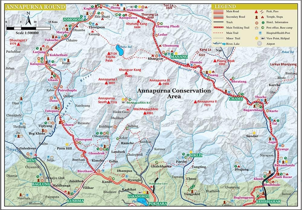
Annapurna Conservation Area
1 Oct 2026 – 10 Oct 2026
Tilicho Hotel & Lodge, Manang
- Published routes
- —
- Regions
- —
- Mapped locations
- —
- Points of interest
- —
What this is
A surveyed index of trekking in Nepal.
Not a pile of uploaded tracks. Every route here is drawn stretch by stretch between real places, measured from the line itself, read by someone other than the person who drew it, and only then published.
Surveyed regions
Nepal, region by region.
Every route is surveyed inside a bounded region. Pick one to see its extent, the routes on it, the places mapped along them and the hazards recorded against them.
Route planner
Plan the trail stop by stop
Draw the line once. The planner does the measuring, and every route in the chart was built exactly this way.
Drop the stops
Place them on a topographic map in the order you walk them.
Segments join up
Each stretch between two stops becomes its own segment, measured from the drawn line.
The figures follow
Distance, ascent, descent, high and low points and walking time, per segment and for the whole route.
Add what's on the way
Hazards on the stretch they affect; tea houses, lodges and passes, with the jeep, bus or flight legs between them.
Featured routes, as measured
0 regions · 0 stops · 0 points of interest
No route has been published yet.
On the trail
A route is more than its line.
Four layers are recorded alongside every published route, so what you read is the walk and not just the distance.
- Points of interest
- 0
- Hazards recorded
- 0
Points of interest
Viewpoints, teahouses, checkpoints and water along the way — each with its type, its elevation, and whether it is open, closed or seasonal.
Hazards
Landslides, closures and river crossings, drawn as a point, a line or an area with their own severity. They belong to the region, and a route picks up the ones its path runs near.
Transportation
How you cover a stretch, not just that it exists. Each segment carries its own mode — on foot, by road, by air — so the drive to the trailhead is not mistaken for a day's walk.
Services
Lodging, food, resupply and repairs, placed where they actually are along a segment and named from a shared catalogue rather than free text.
Nepal, in detail
The Himalaya is not one trail.
It is valleys, passes and villages with their own seasons, their own approaches and their own risks. Mapping them well means mapping them one region, one stretch and one place at a time — and saying plainly how much is actually known about each.
- Surveyed, not uploaded
- A route reaches a public page only after it has been drawn stretch by stretch and read by someone other than the person who drew it.
- One version at a time
- Changing a route that is already live means publishing a new version of it, so the page you are reading never shifts underneath you.
- Thin data is marked thin
- Where a stretch could not be traced against real path data it is shown as an estimate rather than drawn as though it had been surveyed.


Prayer flags on the Mardi Himal ridge, with Machapuchare behind; walkers on a snow-covered ridge in the middle hills.
Common questions
What this is, and how it gets here.
How a route is built, reviewed and published — and what that means for the page you are reading.
HGN Routes is a route index for trekking in Nepal. Trails are mapped segment by segment, described in detail, reviewed, and then published — so what you read on a trail page is a route someone surveyed and someone else checked, not a track file uploaded by a stranger.
It has two halves. A workspace, where a mapping team draws routes and puts them through review; and these public pages, where anyone can read whatever has been published. You are looking at the public half, and it needs no account.

Start somewhere
Explore Nepal differently.
Read a route before you walk it, or build one of your own. The published trail pages are free and need no account.